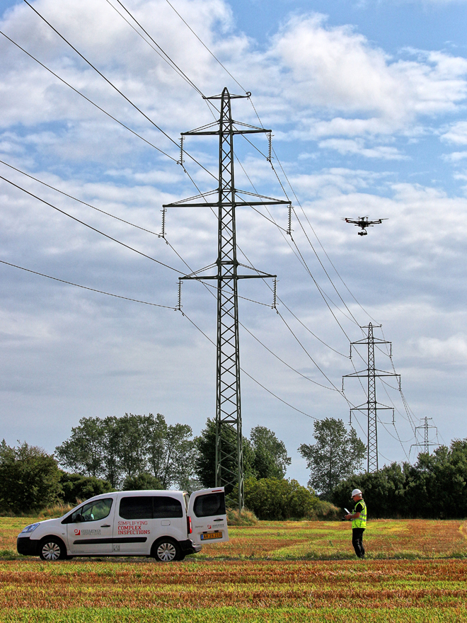
In the application area of infrastructure monitoring, "Drones4Energy" with significant contributions from Fraunhofer IMS is an innovative drone project in which the latest technologies and solutions for the inspection of overhead power lines using autonomous drone systems are being researched and developed. The subject of an Fraunhofer IMS sub-project is an innovative charging concept to enable autonomous operation of the drone system: the drones charge their battery independently via the overhead line cable. The result of the project will be a collaborative drone system for highly efficient inspection of the power grid.
Infrastructure Monitoring


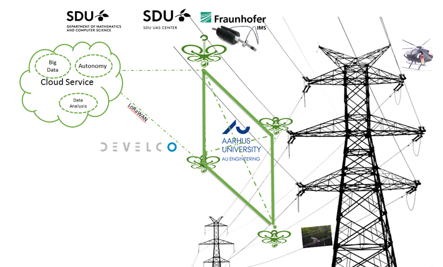
The goal of the project is to be able to monitor overhead power lines in a cost-effective and automated way. Using various sensors such as cameras and LIDAR, the conductor cable will be seamlessly recorded by drones. An analysis software based on machine learning methods evaluates the collected data and automatically detects defects. This eliminates the need for costly helicopter flights for infrastructure monitoring. The efficient use of a drone system is enabled by fully autonomous operation of the individual drone as well as synchronization with other drones in a swarm.
A particular requirement is to achieve the longest possible flight time to make efficient use of autonomous operation. Since battery capacity translates into weight, the ladder cable will serve as an energy source to recharge the drones in between using an inductive harvester. The drone hooks up to the high-voltage line with the harvester and charges the drone's battery. Thus, a significant weight reduction is achieved and a theoretically unlimited operation time is made possible.
A state-of-the-art drone control system is being developed by the University of Southern Denmark's Unmanned Aerial Systems Center (UAS) to stabilize the drone near an active conductor cable as well as keep the harvester attached to the line while being robust to electromagnetic interference. A combination of precision navigation systems, LiDARs and magnetic sensors are used in the drone. The control system analyzes the acquired data and steers the drone, finding the active line, planning a path to it, and finally performing a charge landing procedure. Once the battery is fully charged and the weather permits flight, the control system performs the safe takeoff. Thus, standard APIs (Application Program Interfaces) are being developed by the "Institute for Mathematics & Computer Science" (IMADA) at the University of Southern Denmark to connect the drone to a cloud service that provides information about the current and expected weather, the planned inspection route and the billing schedule. IMADA will also improve the state-of-the-art machine learning algorithm to optimize inspection results and store only relevant inspection data.
To optimize inspection time and improve accuracy, a collaborative drone system will be formed and deployed along the overhead line. A low-power, long-range wireless communication network based on LoRaWAN technology and developed by project partner Develco A/S will enable communication between drones in a swarm. The network will enable inter-drone communication along with Internet communication to monitor and control the drones via the ground control station, which updates the drones' missions and collects inspection results. Software algorithms for cooperating drones such as task distribution and coordination are being researched and developed by Aarhus University.
To validate the developed autonomous drone system, three different use cases are considered based on the experience of the project partner GeoPartner Inspection. The use cases will be implemented in two phases:
- Phase 1. "Indoor" at the drone test center at Odense Airport and.
- Phase 2. "Outdoor" at an active overhead line segment provided by utility EnergiNet.
The startup company "Science Venture Denmark" (SVD) is responsible for creating and implementing the commercial roadmap for Drones4Energy. The business plan is being prepared in detail in parallel with the technical work packages. The commercial strategy focuses on developing the Drones4Energy technologies into products that can be offered on all drones relevant on the market, independent of manufacturers.
More information you get here:
